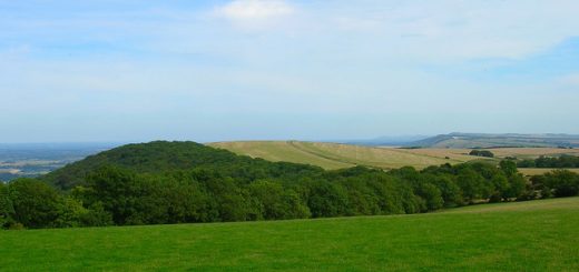
The Devil’s Dyke
Two giant earthworks named the Devil’s Dyke and the Slad, enclose and area of around 40 hectares to the South of St Albans. The area was excavated in 1932 by Sir Mortimer Wheeler, and the ditch was found to have had an original depth of nearly thirteen metres making it a huge undertaking.
 or CC-BY-SA-3.0 (http://creativecommons.org/licenses/by-sa/3.0/)], via Wikimedia Commons")
It may date back around 40BC when the area was occupied by the Cauvellauni tribe ruled by King Cassivellaunus. The tribe was defeated by Julius Caesar in 54BC and there is speculation that the defeat was at this spot.
Excavations inthe 1970’s suggest the area could have been originally settled by Belgae invaders after Belgic and pre-Belgic pottery were discovered.
The earthwork was probably named the Devil’s because of the old folk belief that the Devil created some of the huge earthworks of the past. The term Grim’s ditches relates to a similar belief by the Anglo Saxons.
Directions: To the South of the B653, East of Wheathampstead.
Recent Comments