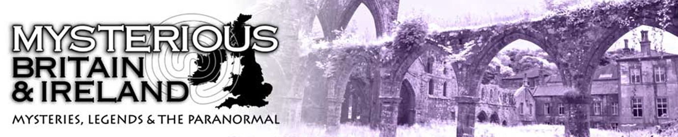
Garn Boduan (279 metres in height) is an Iron Age hill fort situated on a steep isolated volcanic hill to the south of Nefyn. The site was surveyed during the 1950’s, when the remains of more than one hundred and seventy round houses, (of which the remains of about one hundred are identifiable whilst on the ground) were discovered.
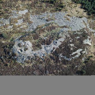
Found on the A5, to the north west of Betws-y-Coed, this much photographed cascade of water is where the Afon Llugwy drops over ancient worn rocks on its journey eastwards. It is the highest continuous waterfall in Wales and one of the most visited beauty spots in the area due to its accessibility.
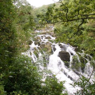
Conwy castle and the city walls were built from the years 1283-1289 by approximately 1,500 workers at the height of the construction, to form one of King Edward I (17th June 1239 – 7th July 1307) fortresses in his ‘Ring of Castles’, used to quell the Welsh uprisings. English citizens were moved in to the town and the Welsh people were banned from living there.
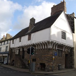
Conwy’s oldest house, Aberconwy (parts of it date back to the 14th Century) on Castle Street, was a medieval merchant’s house, and is currently owned by the National Trust.
This spring on the Great Orme is a water source that doesn’t seem to dry up, even in the driest weather. There is a story associated with the well, which tells of its mysterious formation. Many years ago, the Powell family lived in a dwelling close to where the well is now situated.
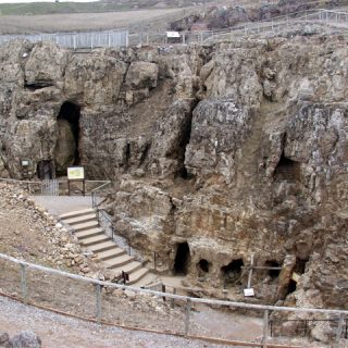
The Great Orme officially has ‘The Largest Prehistoric Copper Mines in the World’ according to the Guinness World Records team. There are more than five miles of tunnels and passageways that have been explored so far. The mining began in the Bronze Age, about four thousand years ago, when the mining tools included animal bones and stone hammers.
The following story by Lauren May entitled ‘Paranormal experts weigh in on dark figure mystery’ appeared in the Epsom Guardian 8 March 2012 and concerns a strange experience reported by multiple witnesses that took place on Valentines Day.
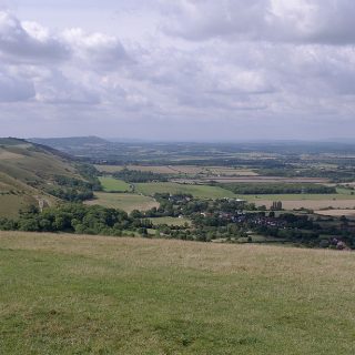
The Devil’s Dyke is a V shaped valley roughly 100 feet deep that was created by erosion caused by an ancient river, however local legends would have us belief that it was created by the Devil himself, hence its name.
There is a long straight road known as ‘Mile Street’ heading out of the village of Bozeat that joins a Roman Road at a T-junction known to the locals as ‘Dungee Corner’.
There was once an Iron Age hill fort at this area called Pen Dinas on the Great Orme. Archaeologists have identified the remains of more than fifty hut circles and some degraded defensive ramparts. Pen Dinas is subsidiary peak that juts out of the Great Orme, and it is a good defensive location for a settlement.
Our Mysterious Britain & Ireland site uses cookies to improve your experience. We assume you are ok with this, but you can opt-out if you wish. AcceptRead More
Privacy & Cookies Policy
Privacy Overview
This website uses cookies to improve your experience while you navigate through the website. Out of these cookies, the cookies that are categorized as necessary are stored on your browser as they are essential for the working of basic functionalities of the website. We also use third-party cookies that help us analyze and understand how you use this website. These cookies will be stored in your browser only with your consent. You also have the option to opt-out of these cookies. But opting out of some of these cookies may have an effect on your browsing experience.
Necessary cookies are absolutely essential for the website to function properly. This category only includes cookies that ensures basic functionalities and security features of the website. These cookies do not store any personal information.
Any cookies that may not be particularly necessary for the website to function and is used specifically to collect user personal data via analytics, ads, other embedded contents are termed as non-necessary cookies. It is mandatory to procure user consent prior to running these cookies on your website.
Recent Comments